The World Climate Service seasonal discussion and forecast for autumn was issued a few days ago, and as always the North Atlantic MSLP pattern featured heavily as an important consideration in the forecast, especially for Europe. Guidance from the leading seasonal dynamical models, including those provided by the Copernicus Climate Change Service, typically provides a significant component of the WCS analysis, but it is important to bear in mind that seasonal dynamical model forecasts have very limited skill – and that the skill varies by model, by location, and by time of year.
To illustrate, the latest multi-model seasonal forecast for MSLP over the North Atlantic and Europe domain is shown below. There is a weak indication of unusual low pressure over Greenland and Iceland, and this suggests that the North Atlantic Oscillation (NAO) may finally return to its positive phase after an extraordinary spell of negative NAO conditions since late April.
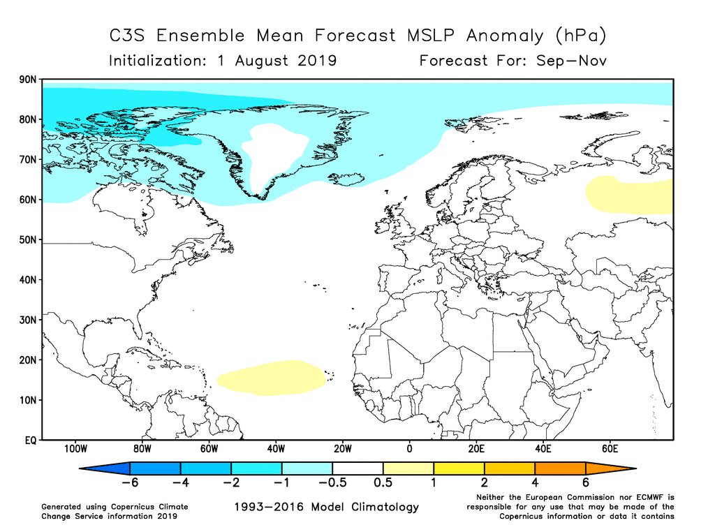
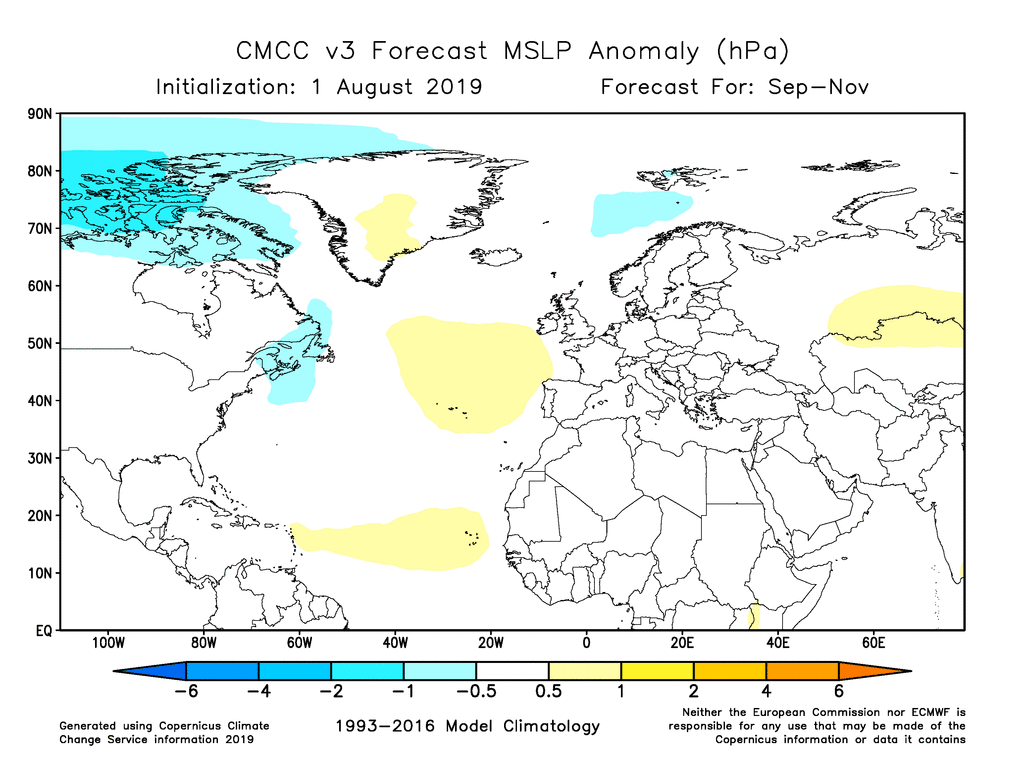
While this forecast shows the main signal from the Copernicus Climate Change Service models, its value is limited by the fact that it includes information from 5 different models, each of which has different performance characteristics and a different level of skill. For instance, the CMCC model shows a slightly different outcome, with a hint of high pressure over Greenland and also to the southwest of the British Isles (see below). Which should we believe? Is there one model that is better than the others?
To address this question, we use the hindcast data from the models to calculate the correlation between predicted and observed autumn MSLP over a 24-year period from 1993 to 2016. The observed data come from the ERA5 reanalysis, also courtesy of the Copernicus program. While a 24-year period is rather short to draw robust conclusions, there are some notable, interesting, and perhaps surprising skill differences between the models:
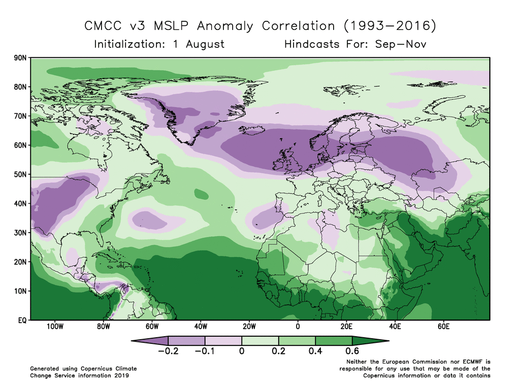
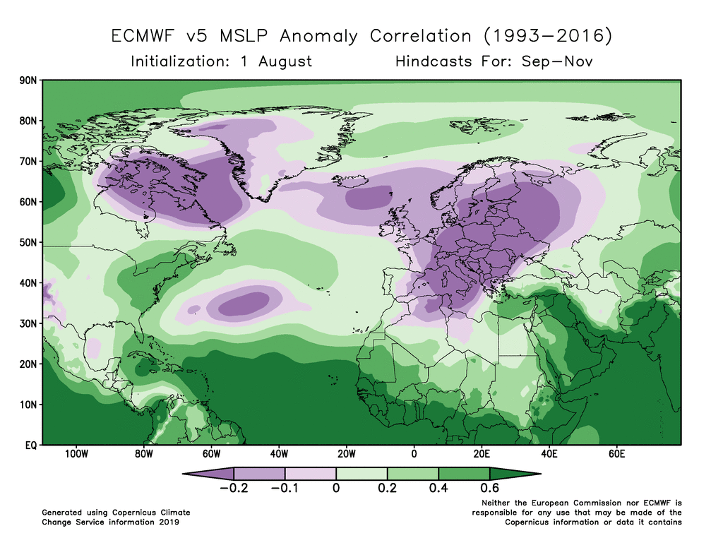
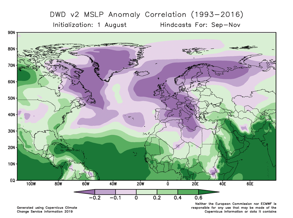
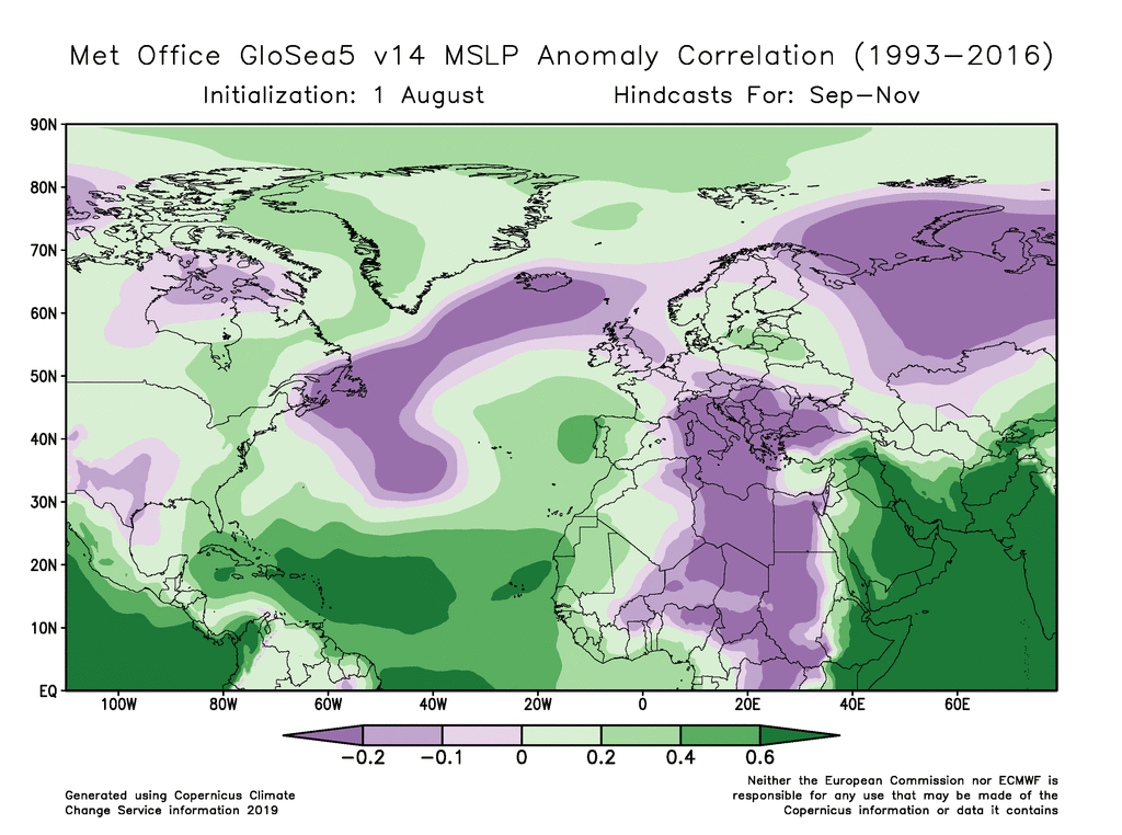
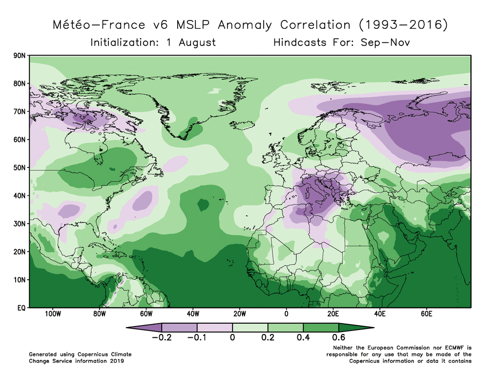
It is interesting to see that all of the models show negative anomaly correlations in some areas, and the positive correlations that do exist are quite small and often statistically insignificant in the middle and high latitudes (the correlation coefficient must exceed about +0.35 to be significant at the 95% level, for a sample size of 24).
It’s also remarkable to see that all but one of the models has negative skill over Iceland, and only the Météo-France model shows positive skill across most of the North Atlantic domain. Based on this metric, the Météo-France model appears to be the best-performing model for autumn MSLP in the areas that are most significant for the NAO phase.
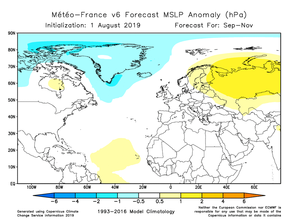
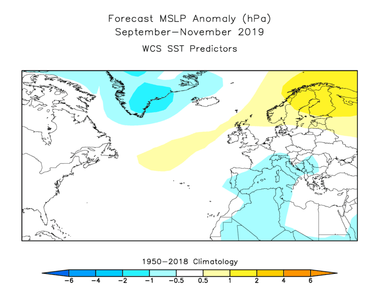
So what does the Météo-France climate model expect for this autumn? The map below shows that it clearly supports the idea of a trough over Greenland, and this suggests that we perhaps should give some credence to the idea of a positive NAO phase returning. Interestingly the model also shows a rather strong indication of high pressure over northern Eurasia, and while this area does not show skill in the Météo-France hindcasts, it is worth noting that a ridge over Scandinavia is also indicated by a World Climate Service statistical model based on recent sea surface temperatures (see the second figure below). The correspondence between the two completely independent MSLP forecasts is quite striking and certainly adds some confidence to the seasonal outlook.
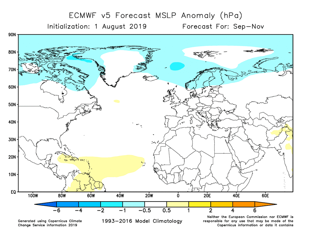
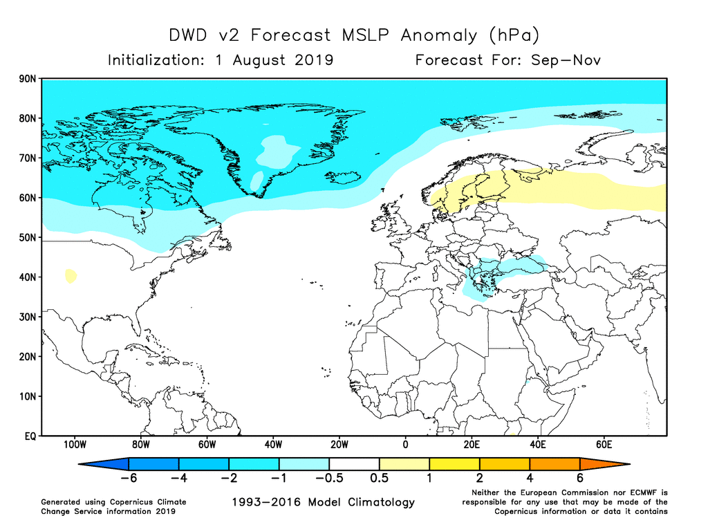
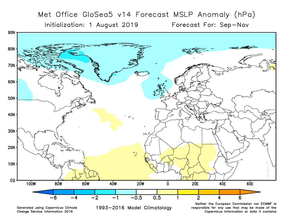
To round out the discussion, the maps below show the MSLP forecasts from the other Copernicus models. The ECMWF forecast expects low pressure to extend eastward over Scandinavia, but based on the model skill analysis there is no reason to believe that this signal will be correct.